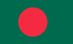
Bangladesh
Bangladesh is in Asia, in the South Asia region. Its capital is Dhaka. It has a population of about 175.7 million and an area of 147,570 km². Its flag has 2 colors, and the one that takes up the most space is dark green, at 79.1% of the total.
The flag of Bangladesh as a pie chart
- Dark green 79.1%
- Red 20.9%
- Design
- Plain background with a shape
- Symbol
- Has a circle
Each slice shows how much of the flag each color covers. It's the same data as CakeFlag, our game where you guess countries from the colors of their flag.
Bangladesh at a glance
- Capital
- Dhaka
- Continent
- Asia
- Region
- South Asia
- Official languages
- Bengali
- Currency
- Bangladeshi taka
- National day
- March 26
- Highest point
- Mowdok tiang (about 1,050 meters)
- Area
- 147,570 km²93rd largest out of 208
- Population
- 175.7 million8th most populous out of 204 · 2025 data
- Population density
- 1,190.5 people/km²9th most densely populated out of 204 · 2025 data
- GDP
- US$ 456.3 billion37th highest GDP out of 200 · 2025 data
- GDP per capita
- US$ 2,59744th lowest GDP per capita out of 200 · 2025 data
- Life expectancy
- 74.9 years95th highest life expectancy out of 204 · 2024 data
More facts
- Joined the UN in 1974
- Drives on the left
Fun facts about Bangladesh
Featured in GeoFacts #13
- Its hand-painted cycle rickshaws were declared Intangible Cultural Heritage by UNESCO in 2023. Source: UNESCO - Rickshaws and rickshaw painting in Dhaka inscribed
- It has one of the longest unbroken natural beaches in the world, about 120 km long. Source: Wikipedia (en) - Cox's Bazar Beach
- It shares the Sundarbans, the world's largest mangrove forest and home of the Bengal tiger. Source: Wikipedia (es) - Sundarbans
Neighboring countries
Bangladesh borders 2 countries:
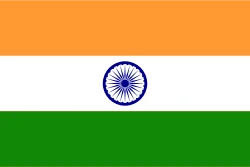 India
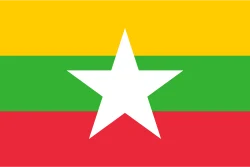 Myanmar
Would you recognize it in a game?
Data: World Bank, world-countries, Wikidata and CIA World Factbook. See all sources.