Angola
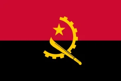
Angola is in Africa, in the Central Africa region. Its capital is Luanda. It has a population of about 39 million and an area of 1,246,700 km². Its flag has 3 colors, and the one that takes up the most space is red, at 48.2% of the total.
The flag of Angola as a pie chart
- Red 48.2%
- Black 47.4%
- Yellow 4.4%
- Design
- Horizontal stripes (2)
- Symbol
- Has a star, a cogwheel and a machete
Each slice shows how much of the flag each color covers. It's the same data as CakeFlag, our game where you guess countries from the colors of their flag.
Angola at a glance
- Capital
- Luanda
- Continent
- Africa
- Region
- Central Africa
- Official languages
- Portuguese
- Currency
- Angolan kwanza
- National day
- November 11
- Highest point
- Mount Moco (about 2,620 meters)
- Area
- 1,246,700 km²23rd largest out of 208
- Population
- 39 million39th most populous out of 204 · 2025 data
- Population density
- 31.3 people/km²50th least densely populated out of 204 · 2025 data
- GDP
- US$ 122.2 billion69th highest GDP out of 200 · 2025 data
- GDP per capita
- US$ 3,12953rd lowest GDP per capita out of 200 · 2025 data
- Life expectancy
- 64.8 years27th lowest life expectancy out of 204 · 2024 data
More facts
- Became independent from Portugal
- Joined the UN in 1976
- Lies entirely in the Southern Hemisphere
Neighboring countries
Angola borders 4 countries:
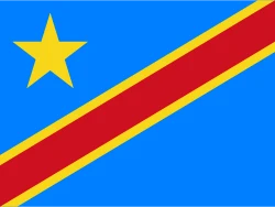 DR Congo
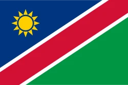 Namibia
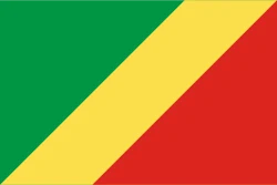 Republic of the Congo
 Zambia
Would you recognize it in a game?
Data: World Bank, world-countries, Wikidata and CIA World Factbook. See all sources.